📝 Summary
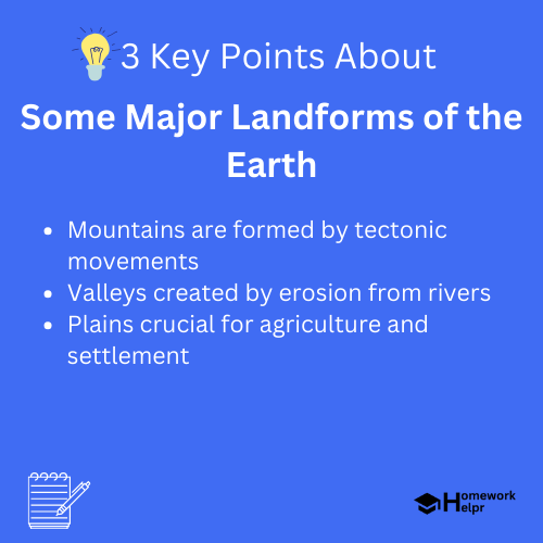
Earth’s landforms shape our environment, influence climate, ecosystems, and human activities. This article explores major landforms including mountains, valleys, plateaus, plains, and deserts. Mountains are formed by tectonic plate movements and erosion, impacting weather patterns and supporting diverse ecosystems. Valleys emerge from erosion, creating fertile lands for agriculture. Plains are flat areas vital for farming, while deserts are dry regions with specialized flora and fauna. Understanding these landforms enhances our appreciation of Earth’s natural beauty and their ecological significance.
Some Major Landforms of the Earth
The Earth is a beautiful and complex planet, and its surface is made up of various landforms that shape our environment. Understanding these landforms is crucial, as they influence climate, ecosystems, and human activities. In this article, we will explore some of the major types of landforms found on Earth, including mountains, valleys, plateaus, plains, and deserts.
Mountains
Mountains are one of the most significant types of landforms on Earth. They are often characterized by their towering peaks and steep slopes. Mountains are formed through various geological processes such as tectonic plate movements, volcanic activity, and erosion. The tallest mountain in the world, Mount Everest, stands at a staggering height of 29,029 feet.

- Tectonic Mountains: Formed due to the collision of Earth’s tectonic plates.
- Volcanic Mountains: Created by volcanic activity when magma erupts from the Earth’s interior.
- Residual Mountains: Formed by the erosion of land over millions of years.
Mountains can influence weather patterns by acting as barriers to air movement, leading to variations in climate on either side of the range. They are also home to diverse ecosystems and unique wildlife.
Definition
Tectonic Plate Movements: The movement of the Earth’s lithosphere which causes earthquakes and volcanic activity.
Examples
Examples of mountains include the Andes in South America and the Rockies in North America.
Valleys
Valleys are low-lying areas situated between mountains or hills and are typically formed by the processes of erosion caused by rivers, glaciers, or wind. They can be classified into:
- U-shaped Valleys: Formed by glacial erosion, resembling the letter ‘U’.
- V-shaped Valleys: Created by river erosion, usually with steep sides.
The characteristics of valleys contribute significantly to their ecosystem. For instance, river valleys often contain fertile soil suitable for agriculture, making them prime locations for human settlements.
Plateaus
Plateaus are elevated flatlands that rise sharply above the surrounding area. They can be formed through several processes, including volcanic activity and the uplift of the Earth’s crust. These landforms have a unique ecosystem and are often rich in minerals.
- Intermontane Plateaus: Located between mountain ranges, such as the Tibetan Plateau.
- Continental Plateaus: Found within continents and are usually flat, like the Colorado Plateau.
Plateaus can experience extreme weather conditions and often have distinct vegetation. The height and isolation of plateaus lead to unique climatic conditions, which can even create localized ecosystems.
❓Did You Know?
The Tibetan Plateau, often referred to as “the Roof of the World,” is the highest and largest plateau globally, reaching elevations of over 15,000 feet above sea level!
Plains
Plains are extensive, flat or gently rolling areas that are crucial for agriculture due to their fertile soils. Typically formed by the deposition of sediments over time, they can be classified into:
- Coastal Plains: Located along coastlines and usually formed by sedimentation.
- Interior Plains: Found inland, characterized by flatland or grasslands.
Plains support agriculture, housing a large portion of the world‚’ population due to the availability of fertile land. Major examples include the Great Plains in North America and the Pampas in Argentina.
Definition
Sedimentation: The process where sediment accumulates and fills in a given area, leading to the formation of flatlands.
Examples
The Great Plains are known for their vast fields of wheat and corn, which contribute significantly to the global food supply.
Deserts
Deserts are regions that receive less than 10 inches of rainfall annually, making them one of the driest landforms on Earth. Often characterized by dunes, rocky plateaus, and sparse vegetation, deserts can be hot like the Sahara or cold like Antarctica. They can be classified into:
- Hot Deserts: Characterized by high temperatures and sparse rain, like the Sahara.
- Cold Deserts: Experience cold winters and are often covered with snow, like the Gobi Desert.
Despite their harsh conditions, deserts are home to uniquely adapted flora and fauna, which have evolved to conserve water and withstand extreme temperatures.
Examples
For instance, the Sahara is known for its dry landscapes, while the Gobi Desert has both hot and cold extremes.
Conclusion
In conclusion, Earth’s landforms are fascinating features that play a crucial role in shaping our environment and influencing life on our planet. From the towering mountains to the expansive plains and the stark deserts, each landform serves a unique purpose and contributes to the diversity of ecosystems. Understanding these features helps us appreciate the natural beauty of our world and the importance of preserving it for future generations.
Related Questions on Some Major Landforms of the Earth
What are the main types of landforms?
Answer: Mountains, valleys, plateaus, plains, and deserts.
How are mountains formed?
Answer: Through tectonic movements, volcanic activity, and erosion.
What role do valleys play in ecosystems?
Answer: They provide fertile soil for agriculture.
Why are plains important for human settlements?
Answer: They support agriculture and house large populations.
